


Walking the Larapinta Trail, NT, Aus.
One of Australia's greatest walks

The Larapinta Walk is a 236km track through the Western McDonald ranges, west of Alice Springs. The walk involves significant climbing (for Australia) and the climate is very dry - with low humidity and only occasional rain. Additionally, the geological landscape is old, very very old. The features you walk over have been laid down over 800 million years ago (Tonian period, Neoprotezoic era). That is when the first most basic life forms on Earth were just emerging. Rock doesn’t survive that long unless it's really bloody hard. This synergy between geology and climate creates what I believe to be one of the most interesting places to walk in Australia, if not the world. They both also directly impact a walker's experience of the trail - getting water can be an issue, and that hard rock will rip your shoes apart like nothing else.
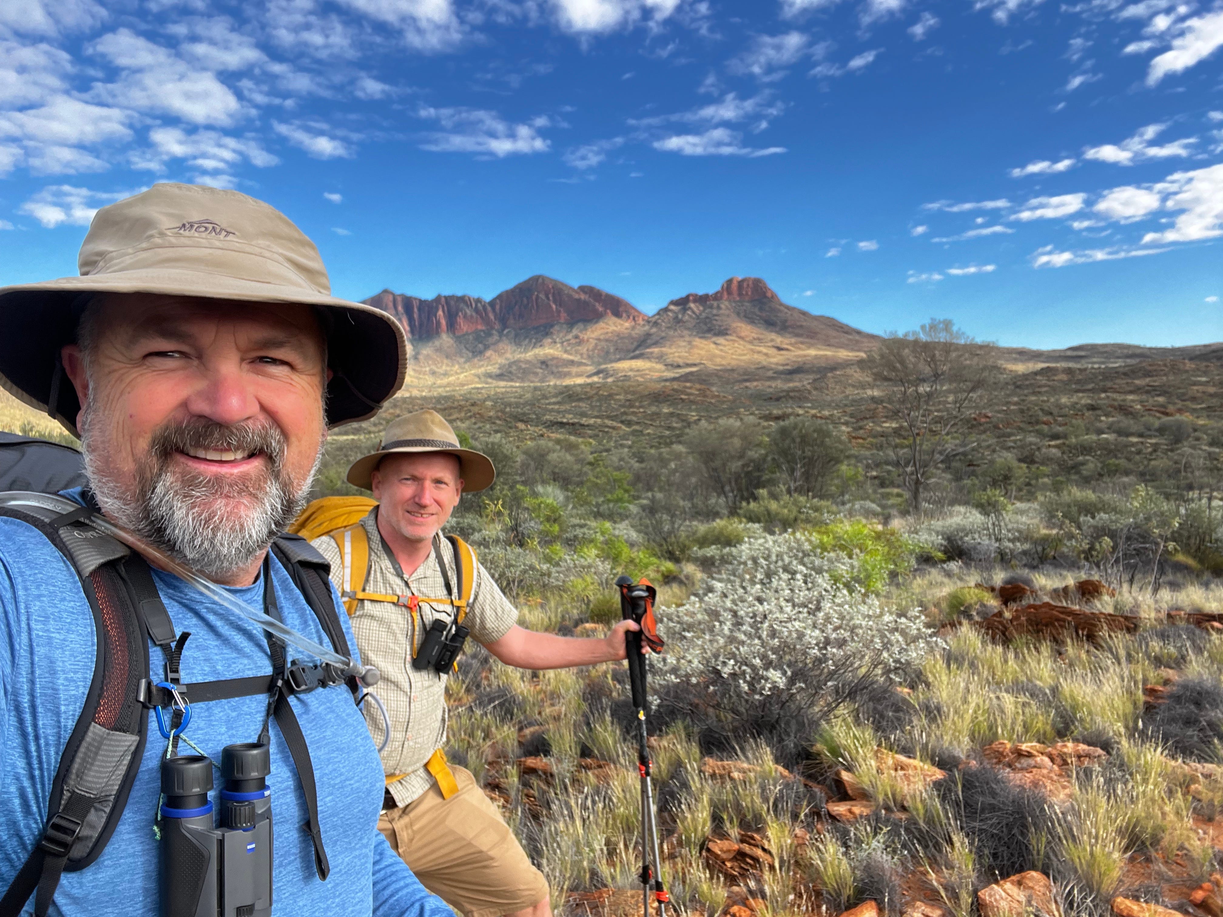
For me, this was a return journey. I completed the first half of the track last year, from Alice Springs to Ellery Creek with my long-time bushwalking friend Craig. This year we were starting from the west, Mt Sonder and walking back toward Alice Springs. Craig would join me until the halfway point, again at Ellery Creek after nine days, I would then continue on solo to Alice Springs.
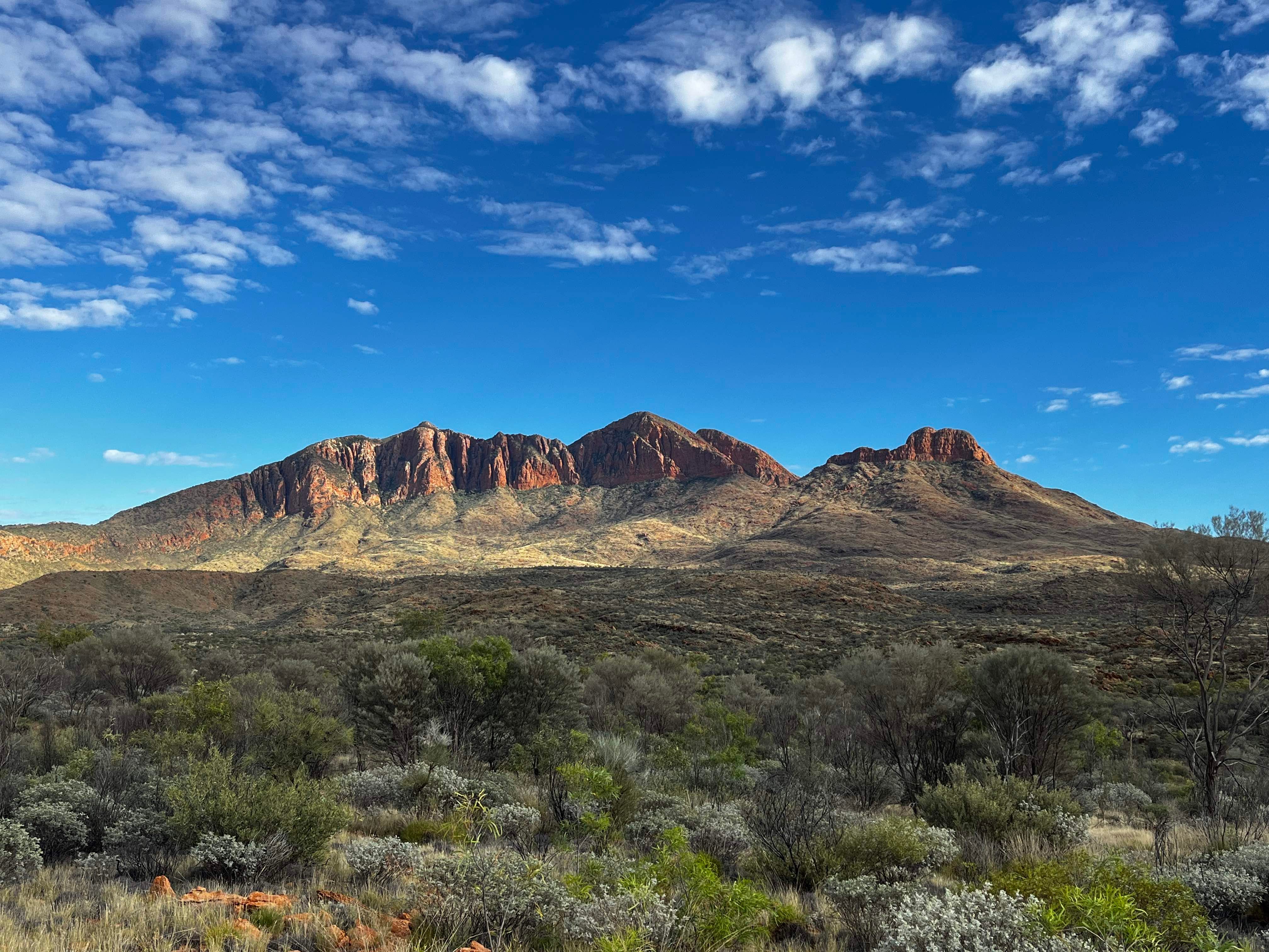
The official start (or end) of the Larapinta is from the top of Mt Sonder (1700m), so of course you have to walk up to the top, which takes three glorious or excruciating hours, depending on your perspective and fitness. The effort does make sense once you stand on the summit, as you gaze over 200km of landscape stretching out to the east along the line of the trail. It fills you with awe, it fills you with dread, it summons something deep within you. I found myself thinking as I stared out toward my next few weeks of effort - “If I can cross that country, I will be a changed person. It will have an impact on me and who I am forever”.
The next morning, as I awoke in my camp at Redbank Gorge, I immediately noticed the stark quietness of the desert. There was no wind, and the bush was so still it seemed brittle. The slightest rustle of a pack or zipper would create a shatter, then it would return to its shape of dense silence.
Over coffee and breakfast we met fellow walker Jobst, who had travelled from Germany to do a number of great Australian walks. Jobst was at the end of his walk, as he started from Alice. He was so passionate about the Larapinta and the wonderful two weeks he had just spent on the trail. He told us some great stories, but was deeply envious when we left. For him, finishing the trail was like completing a great book, and he yearned to be back out there again. This, we found, was a recurring theme of people who complete the trail - a total love and respect for it.
As we moved into the second day, Craig and I developed our familiar walking routines. I plotted routes, campsites and likely water sources. Craig studied and searched for new birds (we both kept a list, see below) and debated what animals we might be able to see - euros (wallaroos), dingoes, snakes, perenties, etc. We both carried binoculars to help us with this task, and a new bird call or fuzzy sighting would cause an immediate halt in progress as we peered, focussed, discussed, consulted our bird apps, and peered again. No doubt this made us much slower than the average walker, but neither of us cared, as nature observation was as much a shared goal of the walk as getting to our destination.
On day three, we approached the Finke River (the oldest river in the world!), responsible for much geological carving up of this region. Normally it is a dry river bed, but heavy rain in February meant there were still substantial water holes present along its length. This made for great habitat to a surprisingly large number of bird species - fairy martins, major mitchell cockatoos, red-tailed black cockatoos, plus herons, dotterels and cormorants! We really were in birdwatching heaven, and we extended our normal stops to include coffee and long rest breaks to soak up as many new birds as we could.
By day four, we had arrived at Ormiston Gorge and the first of our three food drops (boxes of food left at or delivered to places along the trail that have vehicle access). We were spending two nights here, as we wanted to spend a day exploring Ormiston Pound, which is a 9km side trip loop. The area also has hot showers. What a treat!
The pound walk seemed out of this world. Intense wildfires had moved through the area only a month earlier and, whilst most of the trail was spared, this area was seriously scorched. Walking through the pound (think, a massive geological bowl) was like walking on Mars. The dominant colour was orange rock and black vegetation. It prompted Craig to say: “Gee, they could have easily filmed a 1950’s sci movie here, no one would suspect it’s Earth”. Despite the intense fire and hot arid environment, there were still numerous signs of regrowth, so all the unique arid flora will return.
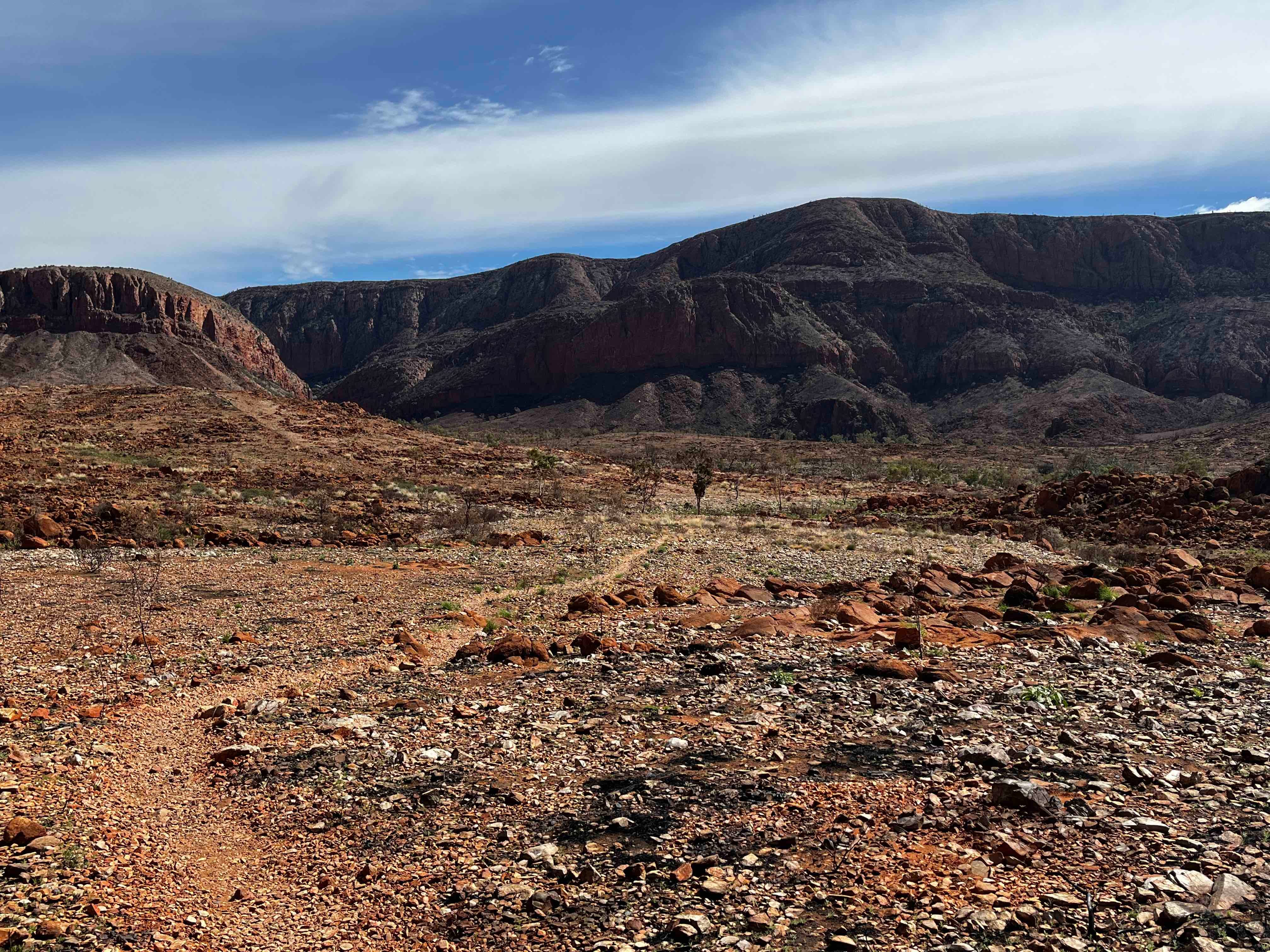
The physical act of “walking” on the Larapinta deserves a description in itself. Remember that very old, very hard rock I mentioned? Well, it’s everywhere. In fact sometimes you find yourself yearning for a flat bit of dirt to plant a foot on. Whilst the trail builders have done their best in surveying the lines for the walk, there is no escaping the fact that many footfalls will hit hard, sharp, angular and sometimes wobbly rock. That meant that our walking experience was dominated by such rock, and that meant that you really had to think about every step on this trail. Walking poles are a great help (about 95% of walkers were using them), but your eyes must still be at your feet every time you move.
When we left Ormiston Gorge on day six, we had full packs with five days of food and plenty of water. Good thing we were starting to get our “hiking legs” because we had a solid three hour climb with those heavy packs to start things off. We fell into our grind pace and steadily climbed 900m of altitude onto a ridge. Once on top we saw some of the most spectacular views yet, seemingly endless ridgelines and ranges stretching off in all points of the compass. “This is the shizzle!” Craig exclaimed, firing off photos. Our spirits were matching the altitude - huge natural highs of nature. Then things changed…
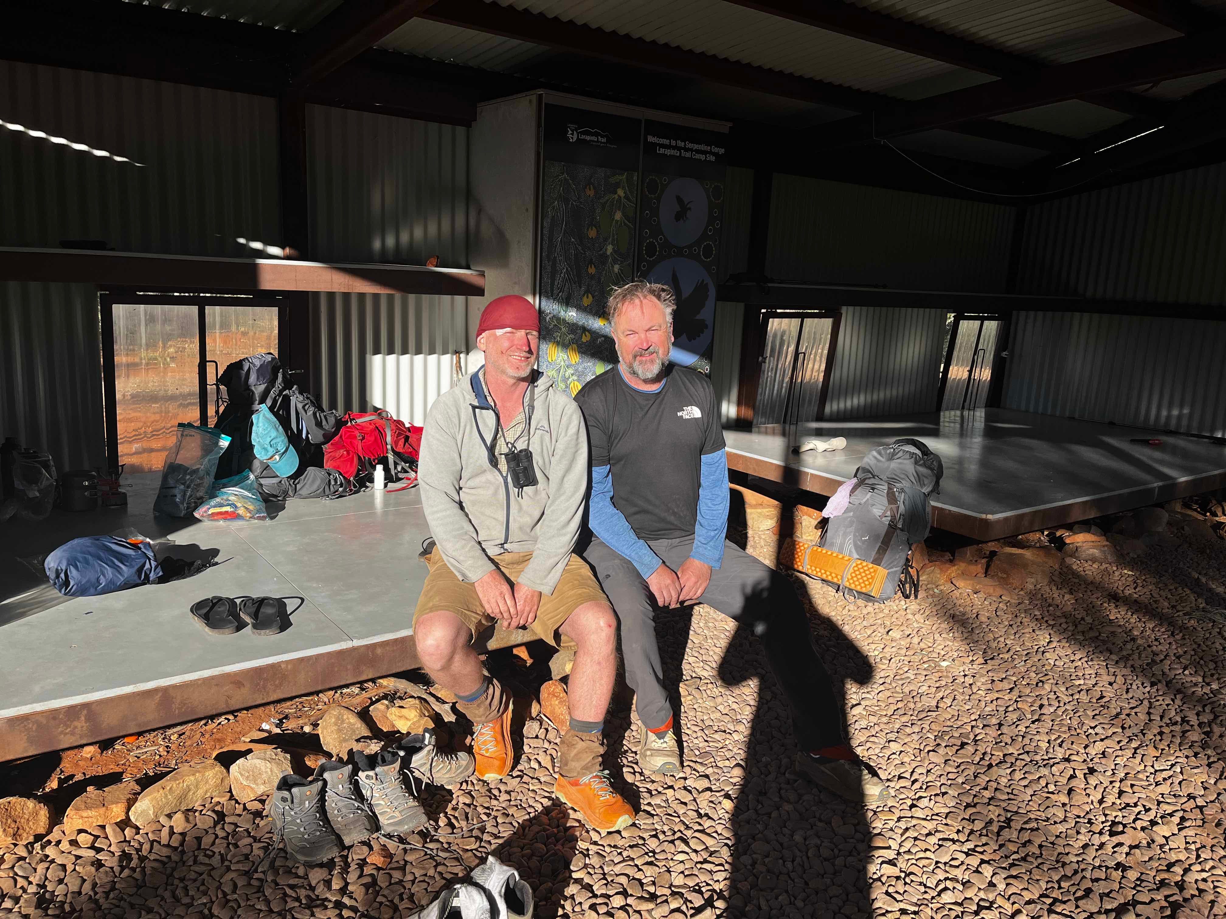
I started walking along the ridge. Craig wanted to take a few more photos. After about a hundred metres I was rounding a boulder when I heard a strange “yelp” sound. Huh? I stopped. I heard another, then turned around. Looking back along the ridge I saw Craig on the ground, head in his hands. Oh shit! That ain’t right. I walked back as quickly as I could over the intensely broken and rocky ground. When I got near him all I heard was “I fell”. Later Craig would describe how he fell down a steep slope, breaking a walking pole and hitting his head directly on one of the very old and hard rocks whilst wearing a full backpack. He was bleeding from a cut above his right eye. When things like this happen, so much rushes through your mind. He is still conscious (that's good), can he see? (barely), can we stop the bleeding? (quick, get the first aid kit), Will he need a rescue? Should I trigger the EPIRB? (not just yet, he is conscious and we need to further assess). At this point another two walkers (Ray and Tim) came upon us. We were only seeing people rarely, and to have two helpful people turn up now was an immense relief. They wasted no time in stopping and going through the assessment with me. They even had better first aid gear than us. Pretty soon, Craig had a suture adhesive on his head wound topped off with Fixomull tape. After about 20 minutes or so he felt ok to stand up. From this point we started to move again, albeit very slowly, over the treacherous ground that now appeared even more menacing than before.
We finally made camp at Waterfall Gorge, after what turned out to be a long and difficult day. The sun had well and truly slipped behind the horizon and we had the last few minutes of light to find a spot to camp. Also at the campsite was Jenny, a trained vet. “I’ll take any doctor right now,” Craig announced. She kindly redressed his wound in a much more professional way than I did. “World War One style” as Craig described my first aid skills. After Jenny had finished neatly repatching him, she kindly apologised for not having any liver treats to give him. LOL !!
The next morning we woke to a freezing cold morning. The good news was that even though Craig now felt his other injuries a bit more (shoulder and hand), he was showing no long term effects from the head knock. So we set off from camp into a freezing headwind blowing from the east. We had an uneventful day, stopping at lunch to have a wash in a remote waterhole in glorious sunshine.
After nine days of walking, we came into Ellery Creek campsite. We found a happy bunch of Year 8 kids on their school camp, all set up in the dry creek bed. When they saw us they were friendly enough to offer us some lunch. However, the most exciting moment for us was a few minutes later when we wandered down the creek and saw birds we had been searching for the whole trip - painted finches !
The next day was Craig’s last. We had walked over 100km together, but now he had to return to Alice Springs and then Melbourne for work. We were both grateful that he had been able to complete the full section as planned, despite incurring a fairly significant injury that would have certainly put him in hospital under normal circumstances. It was a testament to Craig’s resilience and love of the outdoors that splitting his head open didn’t impact his trip. He followed me along the trail for a couple of kilometres, before we said our goodbyes, him turning back, and me continuing walking the trail alone.
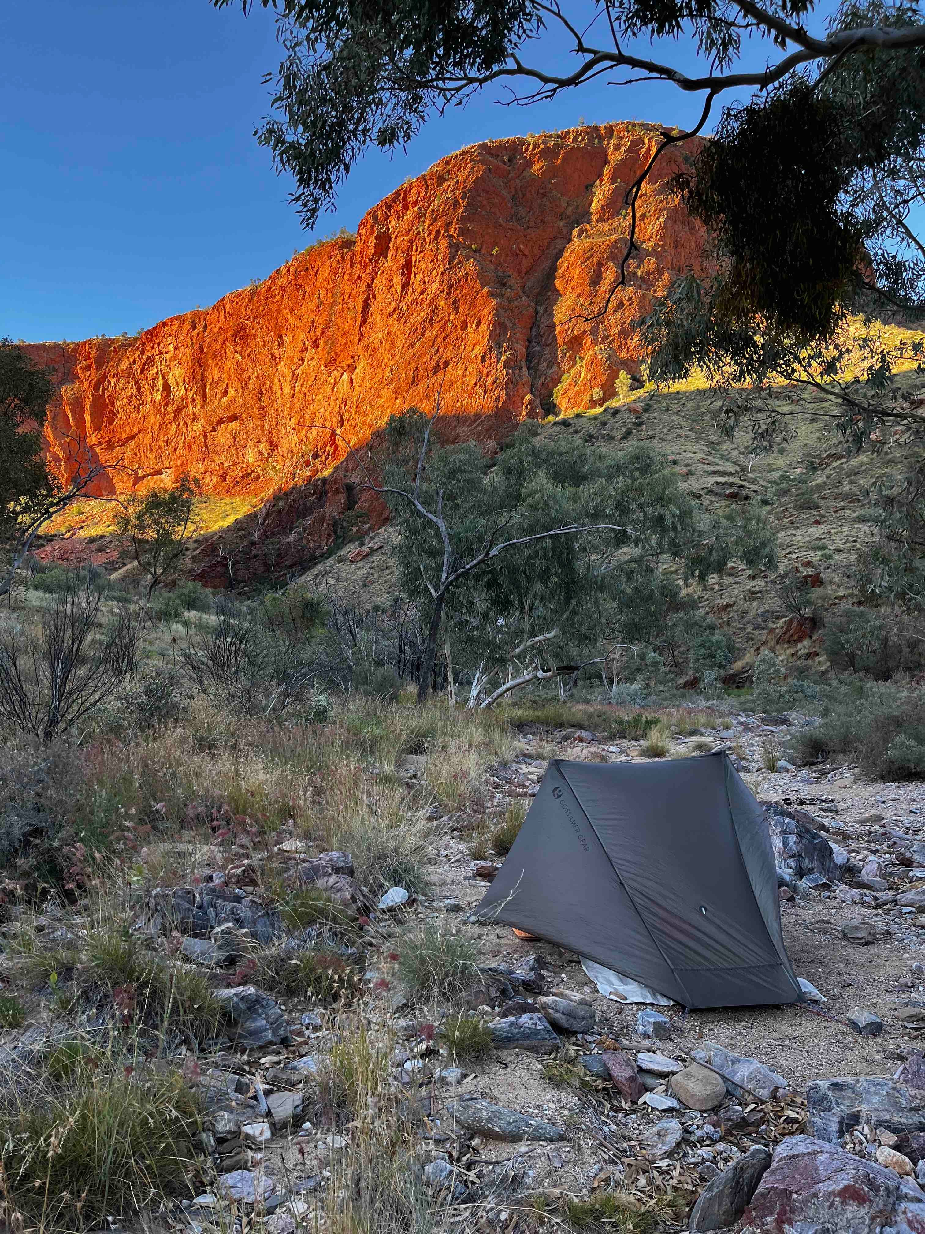
It took me a while to adjust to walking solo, as suddenly it seemed like there was no one else on the trail. The landscape was still captivating as I was moving back into a mountainous region of the trail. Before entering what I knew to be a tough multi-day section (Hugh Gorge to Jay Creek), I camped in a dry creek bed near Ghost Gum Flat. The silence as evening descends is even more staggering when you are alone. The best thing to do is just quietly sit still and absorb it. If you listen carefully it is almost as if you can hear the beginning of time.
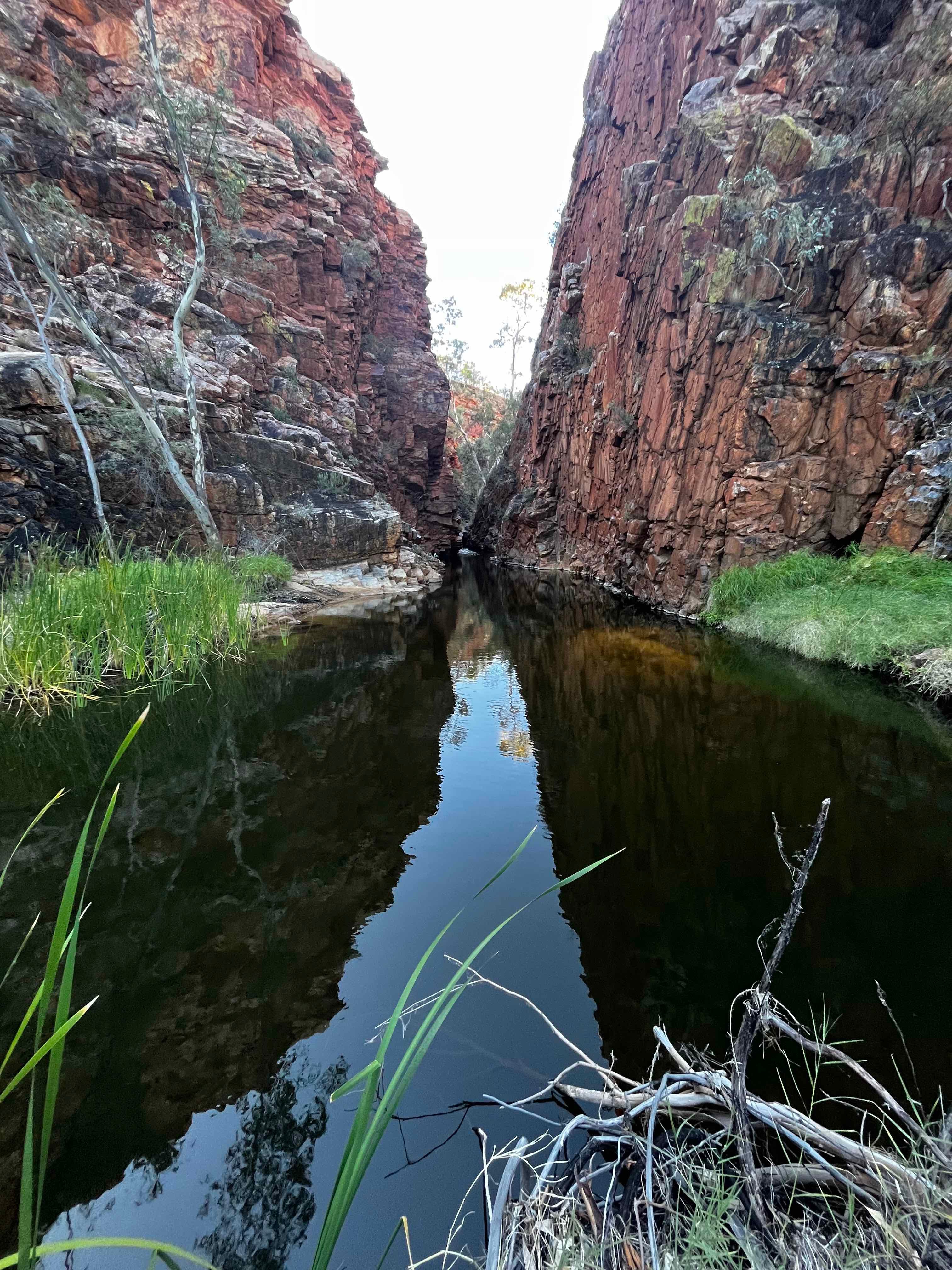
The next day (Day 11), I knew I had to swim a section of the trail. Only a little, but still, the water in the desert is bloody freezing! Having earlier quizzed a number of walkers heading west, I felt pretty confident that I could manage it without having to submerge my pack (which is a big logistical issue involving waterproofing things in dry bags). It turned out that I timed the swim well, arriving there in the early afternoon. I managed to keep my pack dry (using the walker recommended forked branch technique) and decided to treat the swim as a wash opportunity. Afterwards I only had a short walk to my campsite at Hugh Junction, and what a campsite it was - surrounded by enormous cliffs that put on a kaleidoscopic display of reds, oranges, yellows and greys as the sun dipped down at the end of the day. Again, mine was the only tent I could see.
The next morning I didn’t get moving till almost 9am due to having a massive sleep. I had settled in my tent at 7pm the night before and most likely fell asleep around 8pm and didn’t wake up till 7am! These colossal sleeping feats were not uncommon on the trail either. A combination of being physically tired, mentally attuned to the cycle of the sun and free from distractions. You just have to hope you don’t get cold or suffer from disturbances.
I was grateful for my hefty sleep as I had a hefty day ahead - not so much in distance, but this section was easily the most technical of the track. Long climbs that evolve to rock scrambles on Razorback Ridge (aptly named), then slow descents through boulder strewn gullies (Rocky Talus) and finally some good ole dry creek bed rock hopping to finish it off (Spencer Gorge). It was certainly the sort of walking that requires 100% concentration, or “mindful walking” as I heard another hiker refer to it. Either way, it makes you tired both physically and mentally. However, I have a saying that was told to me by one of my early bushwalking companions, Paul. That is: “nature compensates for your efforts”. It certainly did on this one. The views from the ridgetops were spectacular, and I had that satisfying experience of seeing multiple kilometres I had walked stretched out behind me.
I got to my next campsite at Section 4 ⁄ 5 and was expecting another night of solo camping but, right on sunset, Nick came striding into camp from the opposite direction to my travels. He had walked from Jay Creek, two sections in a day! “I had to make up time,'' he said, “I met a girl at Jay Creek and spent a whole extra day there”. “Ok,” I thought, “This guy will be interesting”. Looking at his enormous pack, he explained he was carrying twelve days of food in one go, no food drops - “Waste of money,” he said. Nick was not short on adventure spirit and seemed to possess the fitness and resilience to back it up. Prior to starting the Larapinta (with a 28kg pack) he had paddled the Murray River in a basic kayak from BCF, walked the Heysen Trail (1200km) and rode a bike via the Oodnadatta Track to Alice Springs. Holey Moley! Following the completion of the Larapinta he was planning on hitching back to Alice to resupply, then rewalk the whole length again via the Chewing Ranges. “This trail is nice, but it's a highway, I want to be places with no one. The harder it is, the better I feel,” he explained.
The next morning a group of walkers on a paid Larapinta tour arrived at our camp to brief for the day. Nick picked out one lady and immediately started up a conversation. “Do you know who I am?” he asked her. “I’m in the romance section of your tour brochure!”.
“Oh that must have been in the sealed section,” she replied mischievously. A good laugh was had by all, but as I was leaving I said to Nick, “Looks like you're the Cassonova of the Larapinta, wish I could warn all the ladies ahead”. “Good thing you can't,” he laughed, and strode off with his massive pack to catch up to the tour group. Ah, the people you meet on a bushwalk.
I continued heading east, the path taking me to the summit of Brinkley Bluff. I got there around lunch time and had the place to myself. I took in the majesty of the landscape. The outer ranges flow across the landscape like a giant caterpillar (in fact the Aboriginal dreaming story relates to this mythical form). The colours mix together to produce hues of red, orange, brown and pink. The huge open sky stretches from one horizon to the next, and still that deep, deep desert silence pervades.
A lot of people camp on Brinkley, and I have in the past. The sunsets and sunrise were the best I have ever witnessed. However, tonight had some high winds and possible rain forecast, so I thought it best to continue on down to Standley Chasm.
At Standley Chasm the next morning, I bumped into Jack and Aline. They had braved a summit camp, and ended up copping 20mm of rain and strong winds throughout the night, forcing them off the peak at 5am. Luckily they were young and fit enough to handle it all, and spent the next few hours regrouping at Standley before continuing east. For me, I had a rest day at Standley. It was the first day in about two weeks that I did no serious walking at all. It gave me a chance to wash all my clothes, check all my gear and simply hang around and chat with the other campers. In the evening, one of the caravaners lit a fire and it pulled everyone in that natural vortex an open fire does, sharing stories of travel around Australia and abroad.
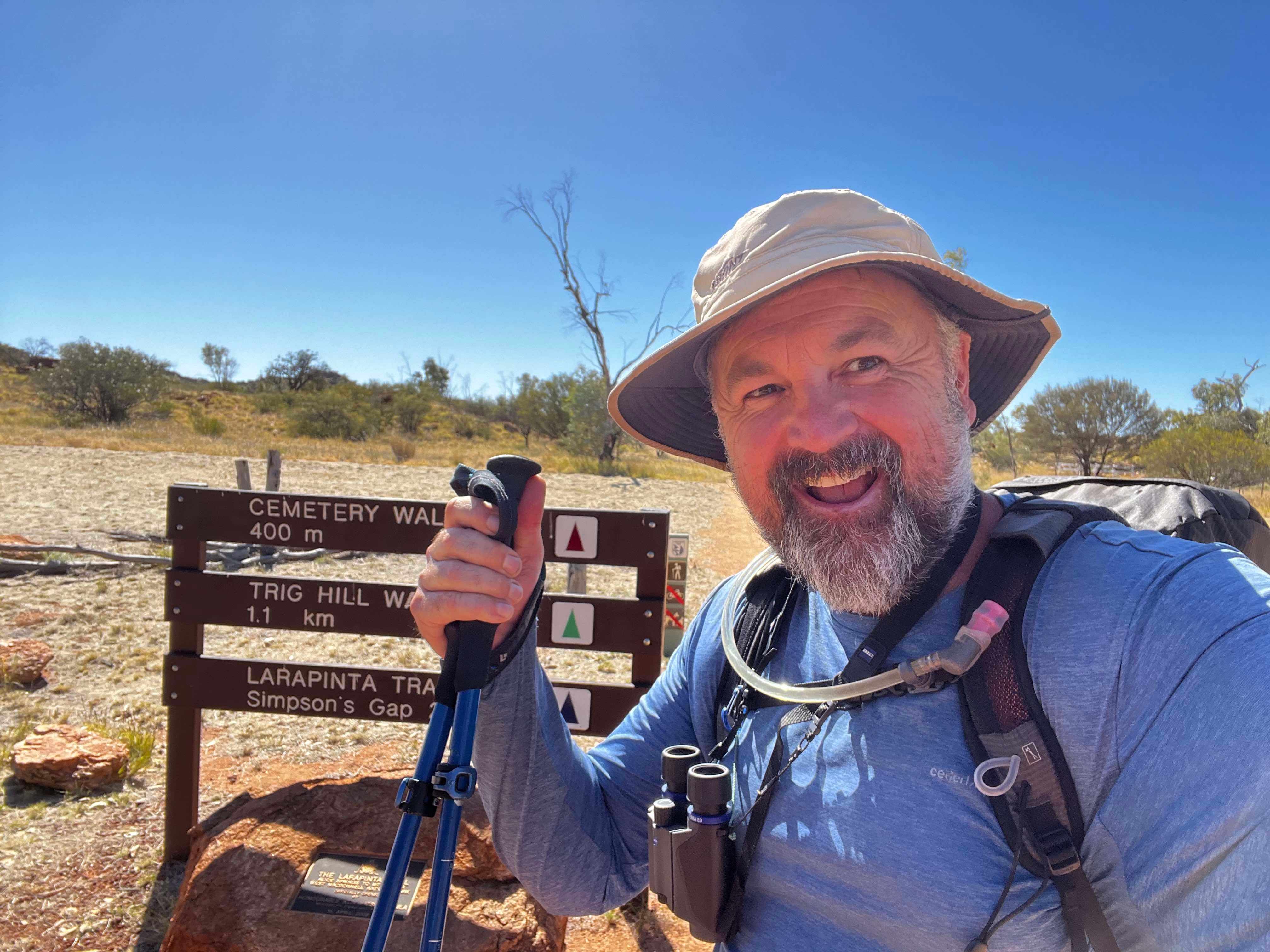
Heading off from Standley I felt refreshed, and ready to tackle the remaining four days back to Alice. I knew the last two days were the easiest walking of the trip so I made sure my phone was loaded with an audio book using the Cafe wi-fi. I was entranced in a slow rock hop down Jay Creek when a big black snake reared its head in my path. I have no real problem with snakes, except when they surprise me like this! You feel that primal flight response kick in, but fast movements on round boulders with a full pack is no easy feat. I managed to back up best I could, and the snake simply held its ground flaring its neck menacingly. The banks were steep and full of spinifex, so I did not relish a bush bash to get around it. I decided to throw some small stones near it, but the snake attacked each one like a demon. Oh great I thought, now I have managed to make it really angry as well. I thought I would just wait and see what it did, and luckily after a few minutes of the stare down, it decided to move up and away from the creek. Gratefully, I continued on.
Arriving at the Jay Creek campsite I met a number of fellow walkers and by nightfall there was a total of eight people. Easily the “busiest” a campsite had been on this trip. The trail had mostly been immensely quiet, certainly compared to the previous year when some walker camps had close to 40 people in them. The consensus on the quietness seemed to relate to the negative press the town of Alice Springs had received in previous months. I hadn’t noticed any problems myself, but the news reports had been enough for many people to cancel their Larapinta walk. From my perspective, it was nice never to have to scramble for a campsite, but I have always enjoyed the social aspect of other walkers on a famous trail like the Larapinta. I find the wilderness brings out the best in people and you often find many shared interests and learn valuable information about the walk.
I spent the next few days walking over undulating country on tracks which are much easier to move over. I stopped at one of my favourite places from the previous year's trip - Bond Gap. It is a permanent waterhole and sign-posted sacred site. It is amazing how this massive and powerful landscape can transform in an instant to something so intimate, gentle and fertile. When you reach Bond Gap, this is what happens, and you can’t help but look and feel the special energy of the place. The cool water fringed by rushes and sedges, the massive basalt cliffs looming like protective guardians, the birds providing their musical backdrop.
My final night (Day 18) was spent at Wallaby Gap, providing just a 14km trip the following day into Alice Springs. I was alone in the camp except for one very friendly Willie Wagtail. I had been hearing about him for a couple of days by walkers going the opposite direction. He certainly lived up to his reputation, happily jumping around me soon after arrival. He didn’t seem that interested in food, and was purely concerned with having company. Even the next day when I left the camp he hopped from tree to tree for the first few hundred metres, a really nice companion for my final night.
On the final day (Day 19), as I climbed the last major ridge of the trip, a splendid view of Alice came to life. It is a nice way to end, walking from the wilderness to the outskirts of town. It felt very natural to be walking back into the “real world”. I was stoked (and relieved) that I had made it. It was a long walk, and a long time to be out in the elements of cold and wind. However, completing a long walk in such a powerful country did change me. Feelings of respect for our land had deepened, gratitude for my family and relationships had increased. A long trip into the wilderness is a bit like putting your life up on the shelf for a while; you can view it more objectively. You are forced into the present by watching each step, and the natural rhythms of day to day on the trail take you over completely. All this combined to make the final steps quite emotional. Even though there wasn’t a person in sight I let out plenty of whoops and hollers.
The Walk at Glance
Dates: 1 May to 20 May 2023
Distance: 251km (includes all side tracks)
Time: 19 days
Campsites: Redbank Gorge, Rocky Bar, Glen Helen Lodge, Ormiston Gorge, Waterfall Gorge, Serpentine Chalet Dam, Serpentine Gorge, North Ellery, Ghost Gum Flat (creekbed), Hugh Junction, Section 4 / 5, Standley Chasm, Jay Creek, Wallaby Gap.
Read: The Luminaries by Eleanor Catton
Listened: The Royal Assassin by Robin Hobb
Wi-Fi: Glen Helen, Standley Chasm
Mobile (Optus): Ormiston, Giles Lookout, Brinkley Bluff, Ellery Creek, east of Simpsons Gap.
Power: Campsites with vehicle access had AC, a number of the walker camps had solar chargers but were unreliable. With my phone on aeroplane mode I could get four days of use for a camera, bird ID and navigation.
Water: Walkers camps and natural waterholes
Research: Larapinta Trail by John & Monica Chapman (copy water points onto map and leave at home), Larapinta Trail Facebook Group, Youtube
Support: Food drops and transport provided by Larapinta Trek and Trail Support
Birds seen on the Larapinta Trail walk (48 species)
Australian Magpie
Australian Ringneck
Black-faced Woodswallow
Black-shouldered Kite
Brown Falcon
Budgerigar
Crested Bellbird
Crested Pigeon
Diamond Dove
Dusky Grasswren
Dusky Moorhen
Fairy Martin
Galah
Golden Whistler
Grey Shrike-Thrush
Grey-crowned Babbler
Grey-headed Honeyeater
Hooded Robin
Inland Thornbill
Little Button-quail
Little Corella
Magpie-lark
Major Mitchell's Cockatoo
Mistletoebird
Nankeen Kestrel
Noisy Miner
Painted Finch
Pied Cormorant
Red-backed Kingfisher
Red-tailed Black-Cockatoo
Rufous Whistler
Singing Honeyeater
Southern Boobook
Spinifex Pigeon
Spiny-cheeked Honeyeater
Splendid Fairy-wren
Spotted Dove
Thick-billed Grasswren
Torresian Crow
Weebill
Western Bowerbird
Whistling Kite
White-browed Babbler
White-faced Heron
White-necked Heron
White-plumed Honeyeater
Willie Wagtail
Yellow-throated Miner
Zebra Finch
A beautiful recounting Chris. It was a privilege sharing the trail with you.
Chris! I so enjoyed reading this! Amazing epic stuff! Big kudos! Is the Heysen Trail on your agenda? We often come across bits of it as it intersects with the Mawson Trail which I’ve ridden 7 times.